Physical Geography 1000
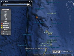
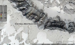
Rat Islands, Aleutian Islands, Alaska
Magnitude: 5.3
Time:5:24:19 PM at the Epicenter
Depth: 26.10 miles
Plate Boundary: ocean-ocean
Why: ocean to ocean, from the picture it looks like maybe a volcanic arc is forming
Magnitude: 5.3
Time:5:24:19 PM at the Epicenter
Depth: 26.10 miles
Plate Boundary: ocean-ocean
Why: ocean to ocean, from the picture it looks like maybe a volcanic arc is forming
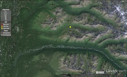
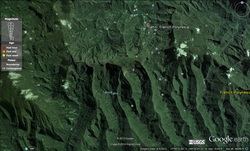
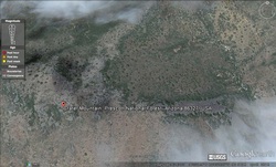
Central, Alaska
Magnitute: 4.5
Date: Tuesday, March 4, 2014
Time: 6:13:19 pm at epicenter
Depth: 29.20 miles
Plate Boundary: Continental - Continental
Why: I feel that this is continental-continental because it is so far inland that the convergent boundary would be between two continental plates. No subduction takes place because the continental crust is buoyant.
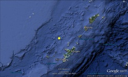
Ryukyu Islands, Japan
Magnitude: 6.7
Date: Monday, March 3, 2014
Time: 5:11:22 Epicenter
Depth: 79.16 miles
Boundary: ocean-contiental
Why?: This earthquake happened out in the ocean but close to continental islands...these islands could have been formed because of the earthquake out in the ocean.
Magnitude: 6.7
Date: Monday, March 3, 2014
Time: 5:11:22 Epicenter
Depth: 79.16 miles
Boundary: ocean-contiental
Why?: This earthquake happened out in the ocean but close to continental islands...these islands could have been formed because of the earthquake out in the ocean.
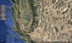
Central California
Magnitude: 3.0 (not quite 4.0)
Date: 3/5/2014
Time: 1:29:59 pm Epicenter time
Depth: 3.42 miles
Boundary: Transform
Why?: This earthquake was not quite 4.0 magnitude, but it is right along the San Andreas fault which would make it a transform boundary
Magnitude: 3.0 (not quite 4.0)
Date: 3/5/2014
Time: 1:29:59 pm Epicenter time
Depth: 3.42 miles
Boundary: Transform
Why?: This earthquake was not quite 4.0 magnitude, but it is right along the San Andreas fault which would make it a transform boundary
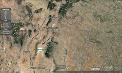
New Mexico
After spending hours on google, earth, trying to find an earthquake caused by a divergent earthquake, I finally had to google locations on where I could find one. I found an article from the Center of Educational Technologies which stated the following: Where a divergent boundary crosses the land, the rift valleys which form are typically 30 to 50 kilometers wide. Examples include the East Africa rift in Kenya and Ethiopia, and the Rio Grande rift in New Mexico. Where a divergent boundary crosses the ocean floor, the rift valley is much narrower, only a kilometer or less across, and it runs along the top of a midoceanic ridge. Oceanic ridges rise a kilometer or so above the ocean floor and form a global network tens of thousands of miles long. Examples include the Mid-Atlantic ridge and the East Pacific Rise.
I have provided a photo of the Rio Grande rift in New Mexico, showing the divergent boundary.
Mt. Saint Helens
Type of Volcano: Composite
Boundary: Convergent
Mt Helens in the USA is lies on a Convergent boundary plate. These are the most geologically active plate, the mountain lies mainly on the Continental crust of the Convergent boundary plate.
Type of Volcano: Composite
Boundary: Convergent
Mt Helens in the USA is lies on a Convergent boundary plate. These are the most geologically active plate, the mountain lies mainly on the Continental crust of the Convergent boundary plate.
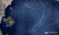
Tahiti
Type of Volcano: Shield
Boundary: Divergent---Where two plates pull apart and lava flows into the gap to form a volcano. Shield volcanos are also formed on hot spots.
Type of Volcano: Shield
Boundary: Divergent---Where two plates pull apart and lava flows into the gap to form a volcano. Shield volcanos are also formed on hot spots.
Crater Mountain, Arizona
Type of Volcano: Cinder Cone
Boundary: Converging Plate Boundaries
Type of Volcano: Cinder Cone
Boundary: Converging Plate Boundaries
Crater Lake, Oregon
Type of Volcano: Caldera
Boundary: Crater Lake lies in the caldera of a Cascades volcano. The Cascades are the result of the small Juan de Fuca plate being subducted under the North American plate (convergent boundary), partially melting, then rising as magma to form a chain of volcanoes. Since the surface boundary between the plates is offshore, the volcanoes themselves are located on the North American plate.
Reflection
The quote by J. Tuzo Wilson, "The earth, instead of appearing as an inert statue is a living, mobile thing," has been the most influential on how my perspective has changed regarding our beautiful planet. I never thought of earth as a “living thing,” but through this course, I have realized how earth is truly “living.” Learning about the plate tectonics has illuminated not only how the earth was created, and is constantly changing, but how much we still need to learn. I gained a greater appreciation about processes that occur, which have made me thirsty for more knowledge.
I had a hard time with the e-portfolio assignment as Google Earth was hard for me to navigate. Google Earth would kick me off, I had to re-load the real time earthquakes, and then it would kick me off again. This cycle happened over and over again, making the assignment extremely time consuming and frustrating. Further, it was difficult for me to distinguish what type of plate tectonics each earthquake was, and I had to refer to my book quite often. I know that I am a “slower learner,” and it takes me longer to wrap my head around things, but I felt that I would understand it when I read the book, but when trying to interpret or apply my knowledge using the “real-time” images, I would second guess myself, or it wouldn’t make sense to me. Thus, I am sure one or more of my images could be wrong in describing what plate tectonic it is.
As a little girl growing up in Utah along the Wasatch fault, I was always frightened for a big earthquake to happen. Our family lived right below the mouth of Little Cottonwood Canyon, and earthquakes were the topic of conversation quite a bit. I remember a distinct fear instilled in me, which makes me wonder if that isn’t part of the reason I moved out to the west side when I got married. I honestly feel that learning about earthquakes and volcanoes in this section has been rather fascinating. It has been fun to learn how the plate tectonics work, and that there is more to earth than its surface. The way I felt about earthquakes before taking this class has changed. Before, I had this blind fear of a big earthquake happening. Now, I have an understanding of how earthquakes happen, and a new knowledge about the Wasatch Fault. Having this understanding has brought a confidence and understanding, which makes me wish that I would have taken this class many years ago. I am anxious to expose and teach my children about physical geography, and will be keeping this text book. (A vacation to Yellowstone in the near future might be happening, too!)